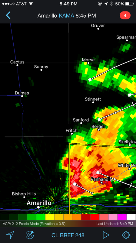
“So, if you get into trouble, just point right at it. I mean, cars are meant to withstand the most force from the front, right? 120 mph. 140 mph. It’s best to take it head on instead of broadside or from behind because it’s not built to withstand pressure from that direction.” At that point, Amy interrupted Dave and said, “What?!?” 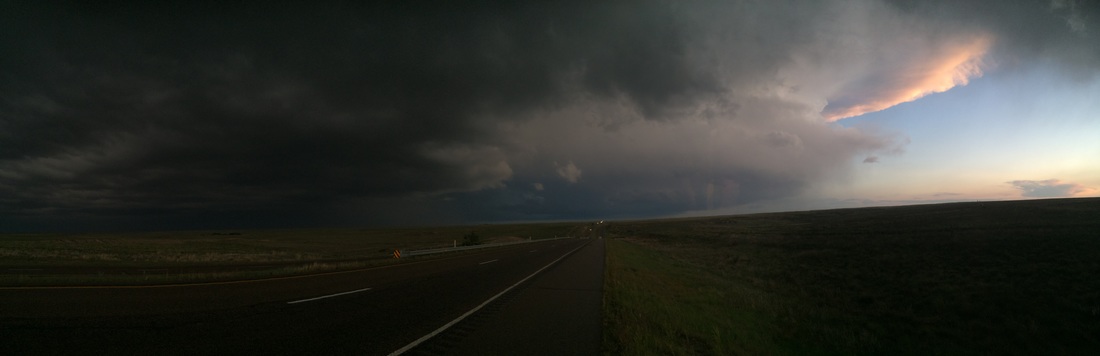 Clearly, Dave had gone right back into his tornado chasing days and was excitedly telling us stories interspersed with ‘nuggets of wisdom’ since we were heading down into “Tornado Alley”. Without seeming to hear Amy, Dave then pulled out his phone and told us a few different apps to use to track the storms as they generally move east-northeast and since the roads are gridded out north and south, you need to stay below the storms as you track them so you always have ways to escape. “Wait, wait. What did you say about the direction of pointing the car?!?”
Dave looked up at Amy and smiled a broad smile and stated, “Well, uh, I mean, that’s not going to happen but, you know, it’s good to know.” Our collective laugh broke the tension as Amy made me and the boys (read: me, again) promise not to chase storms across the Texas-Oklahoma panhandle. I looked directly at her and said we would not chase storms … without detaching the rig first. Another joke but heartfelt; we were not about to hunt for tornados across the southern US plains, but we were heading directly into their breeding grounds. 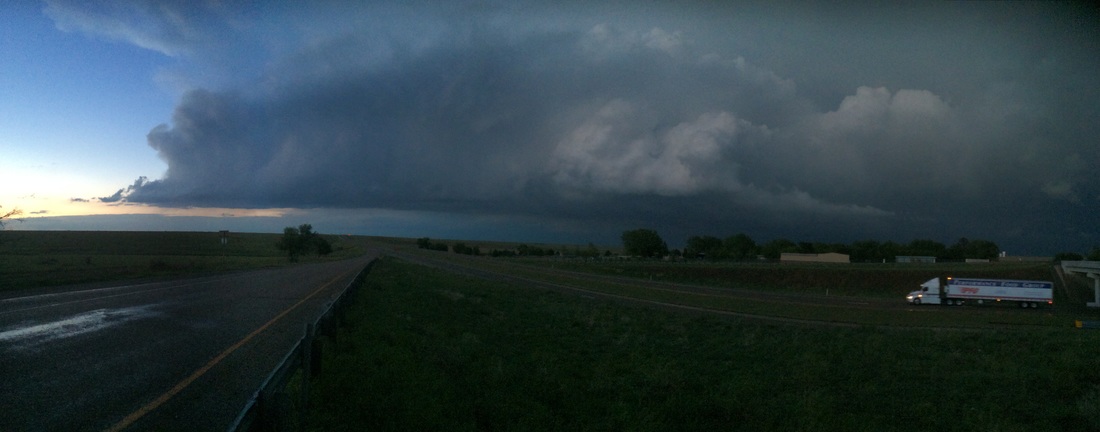
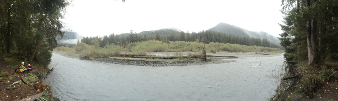
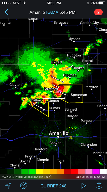
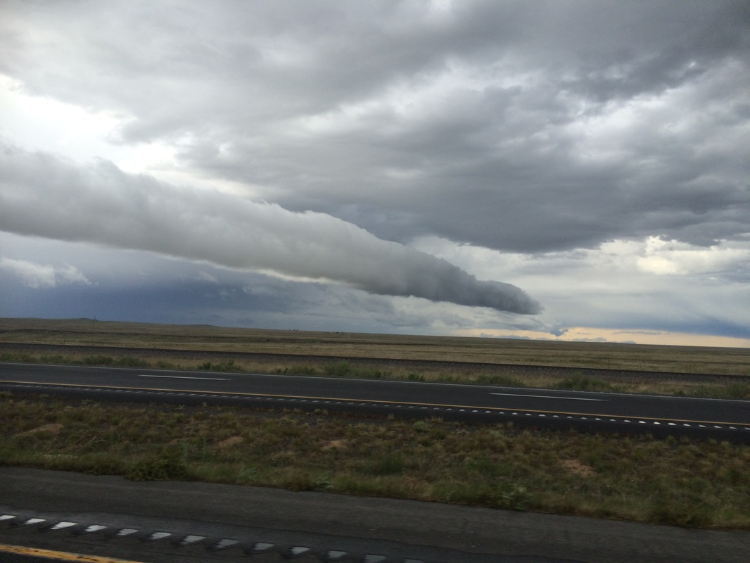
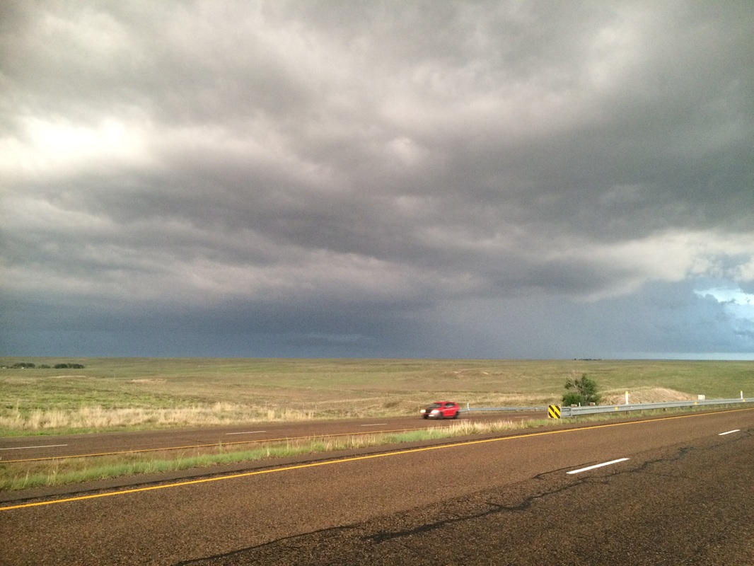
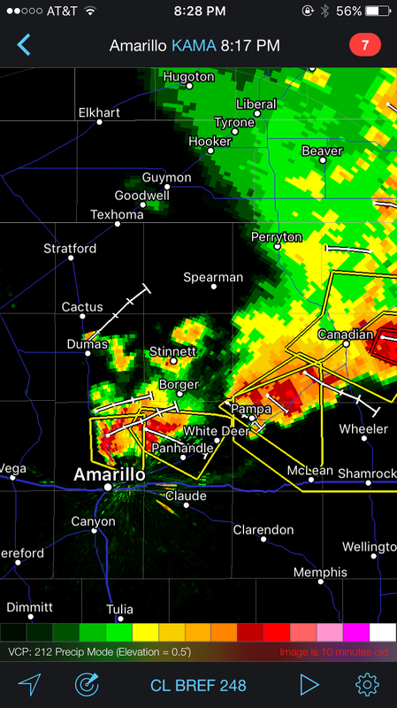
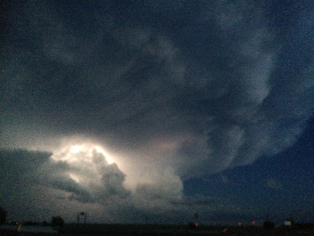
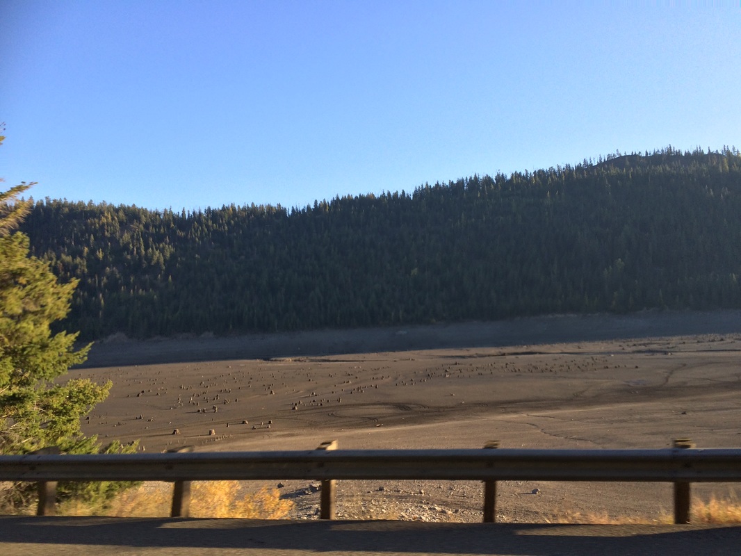
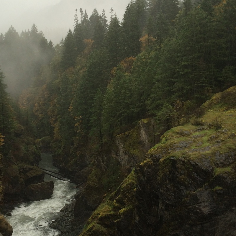
Finally, and with Dave’s blessings via bursts of texts with attached and updated radar images, we meandered east towards the monster and Lake Meredith, our boondocking spot for the night. For an entire afternoon and evening we had been skirting on the edge of a series of storms and luckily we were on the back edge of this one. The back edge that saw the beauty in the monster as the sunset revealed its gorgeous tropospheric plumes above rainbows brilliant in the growling darkness churning across the earth. Falling asleep we were fortunate to never feel its wrath. 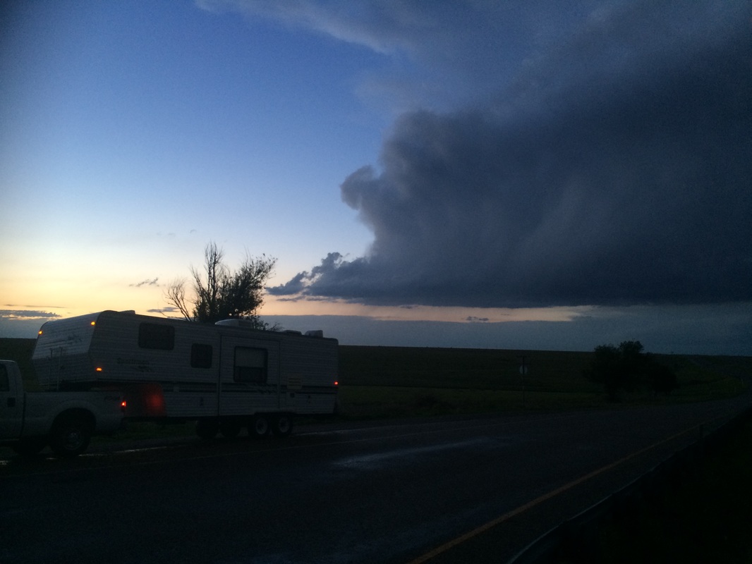
2 Comments
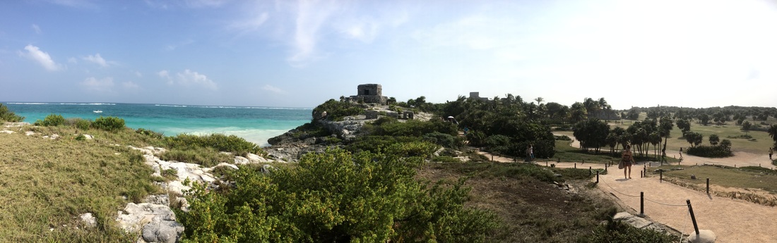
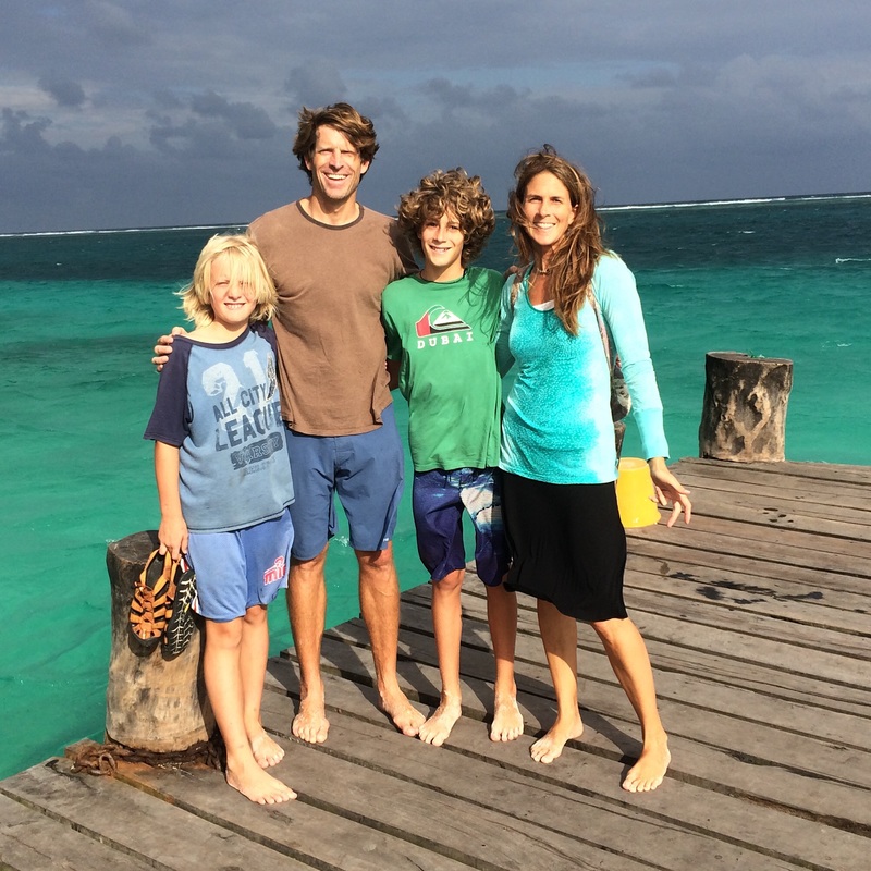
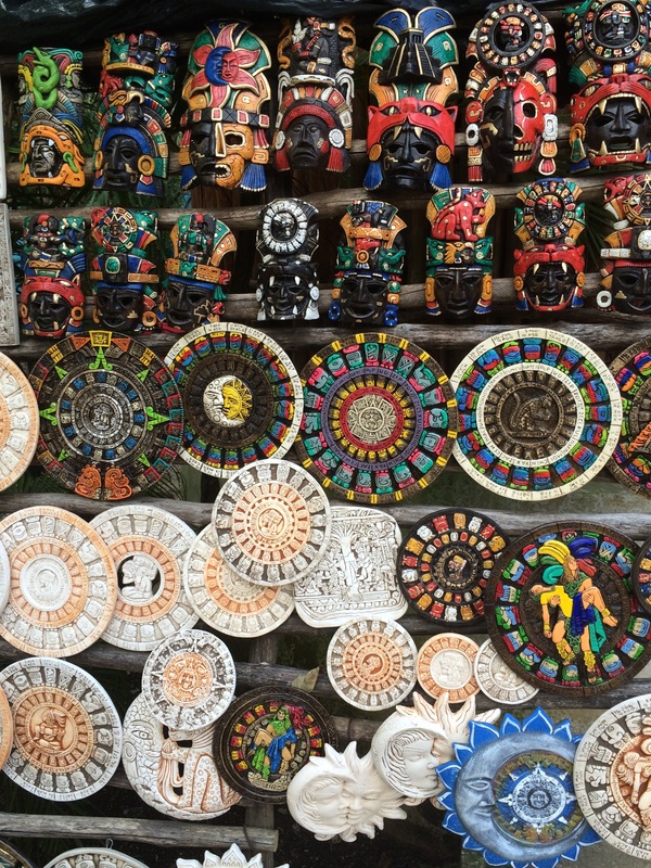
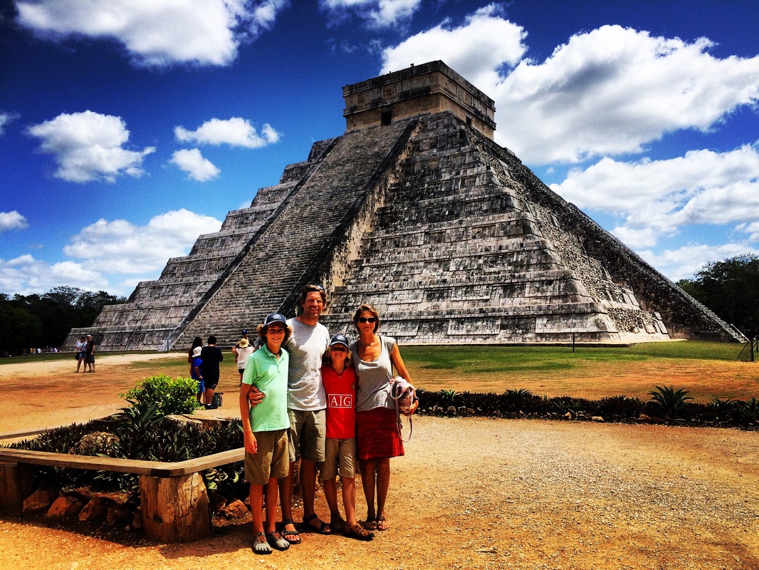
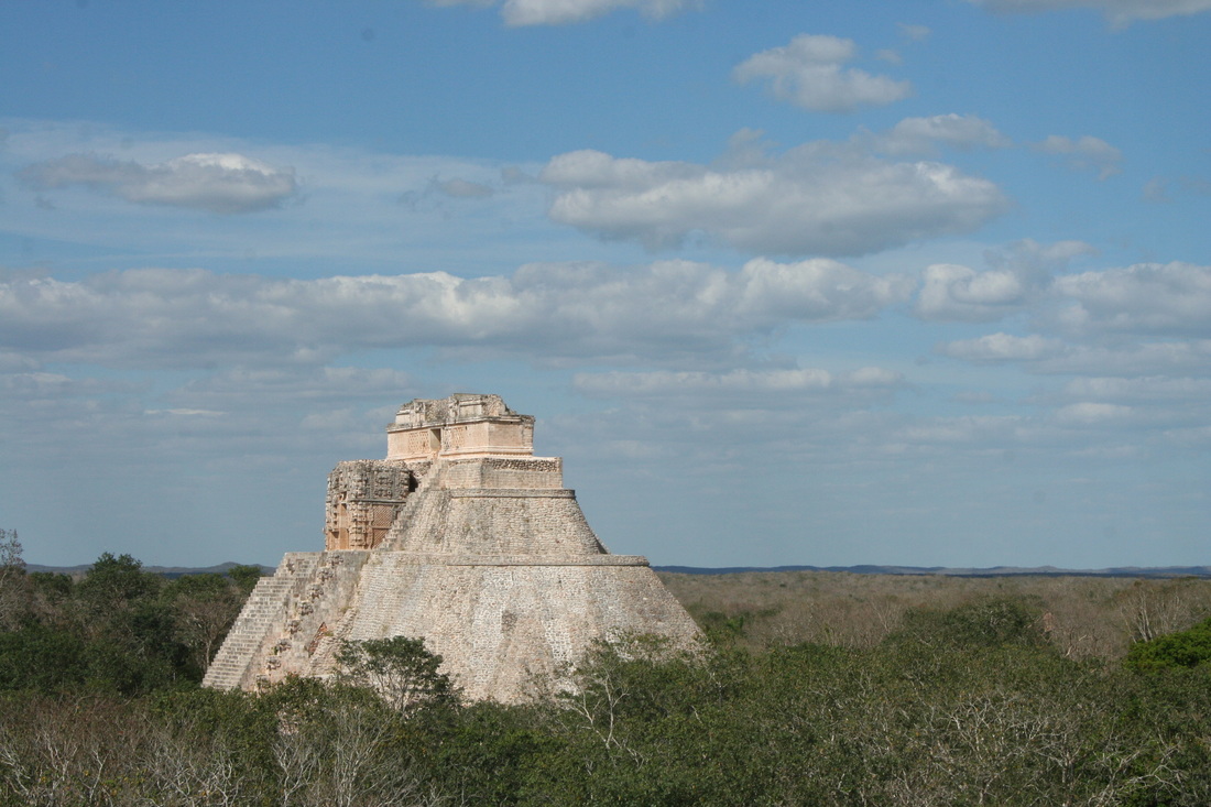
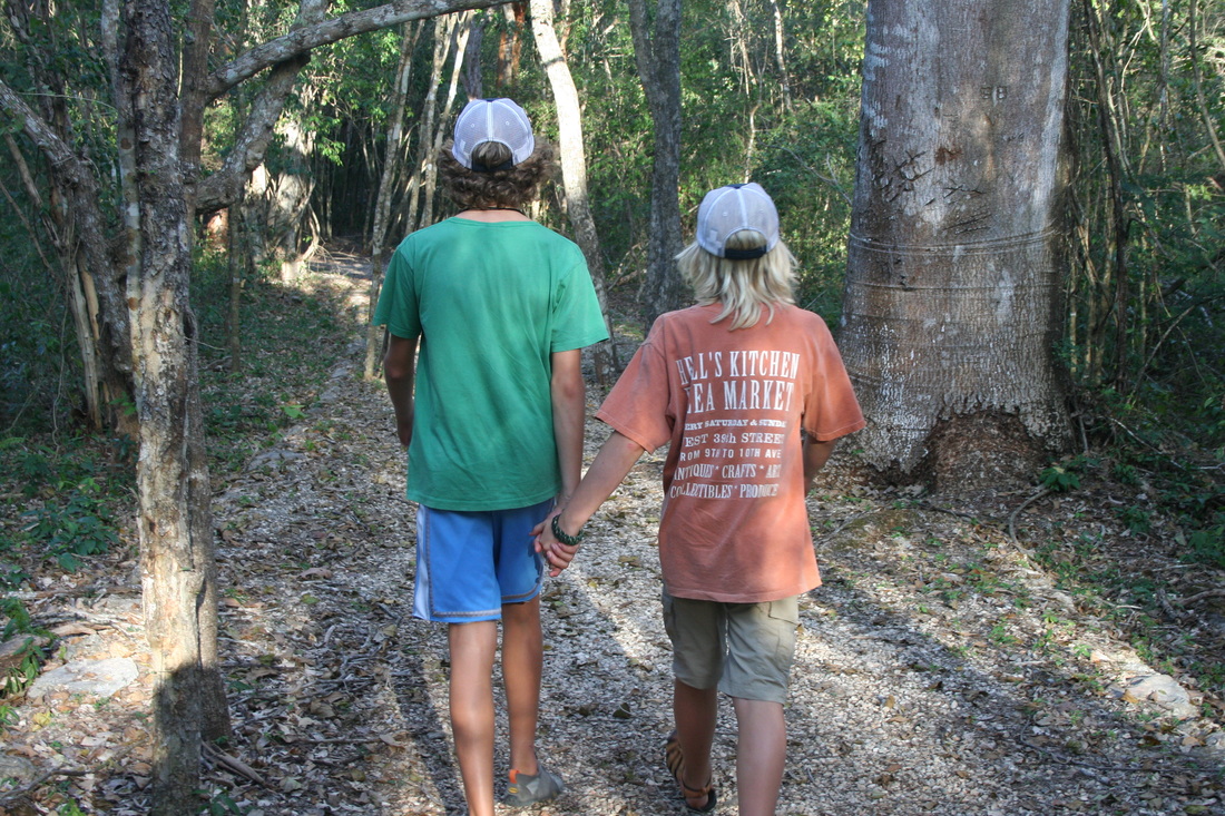
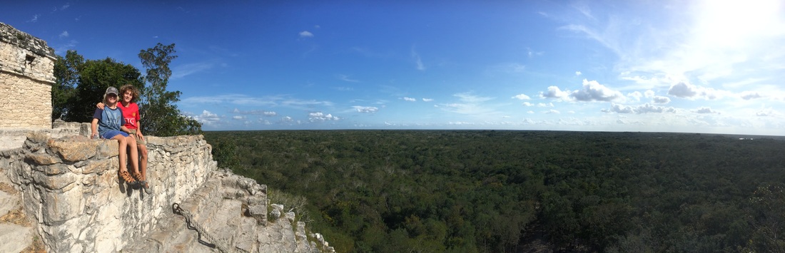 If you haven’t had the opportunity to visit the Yucatan area, I would highly recommend a visit to this beautiful peninsula within Mexico. Not only is it a stunning beach location on what is known as the Mayan Riviera, it is also a region full of so much culture and geological wonder. While a large number of Americans fly to Cancun and never leave their fancy resort and explore, we departed Cancun as quickly as we could and based ourselves out of a small fishing village called Puerto Morelos for the first week of our visit. Puerto Morelos was recommended to us by friends and it was exactly what we had hoped for, muy tranquilo, more local than not, and lots of overall ambience.
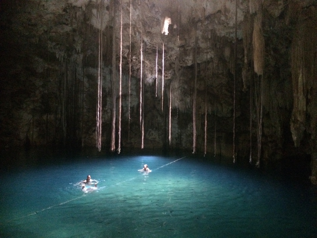
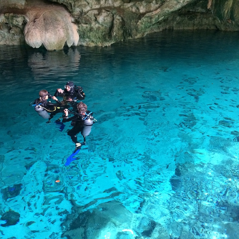
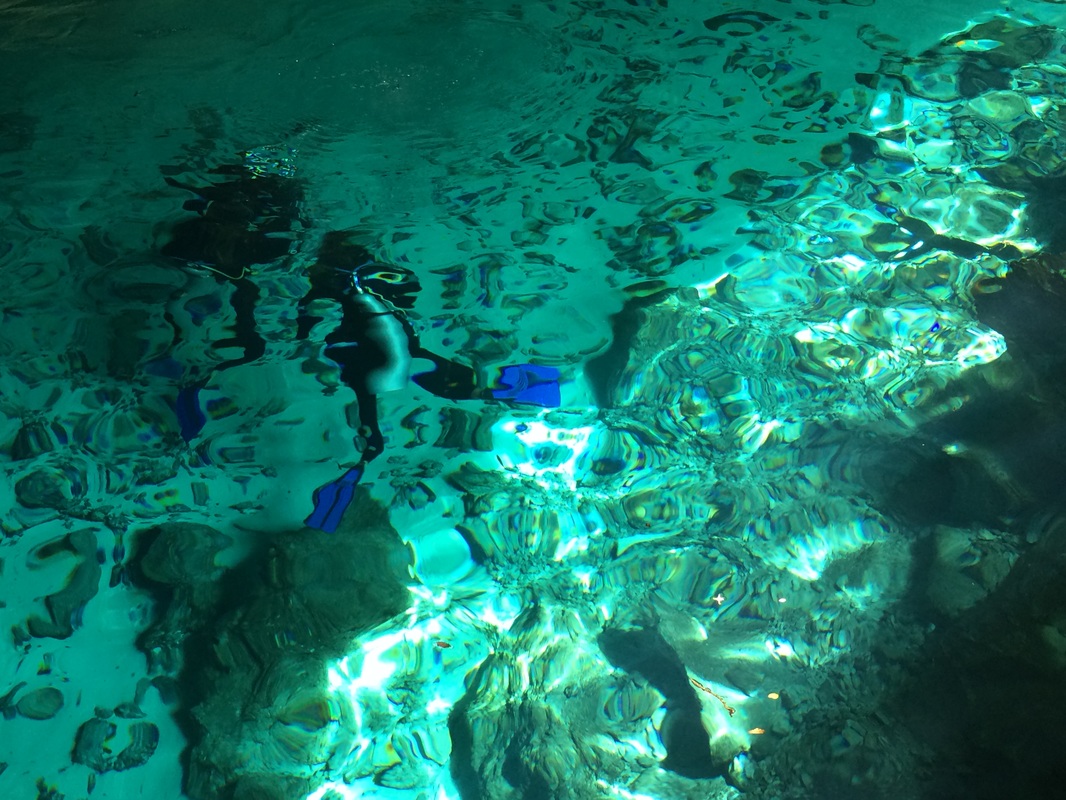
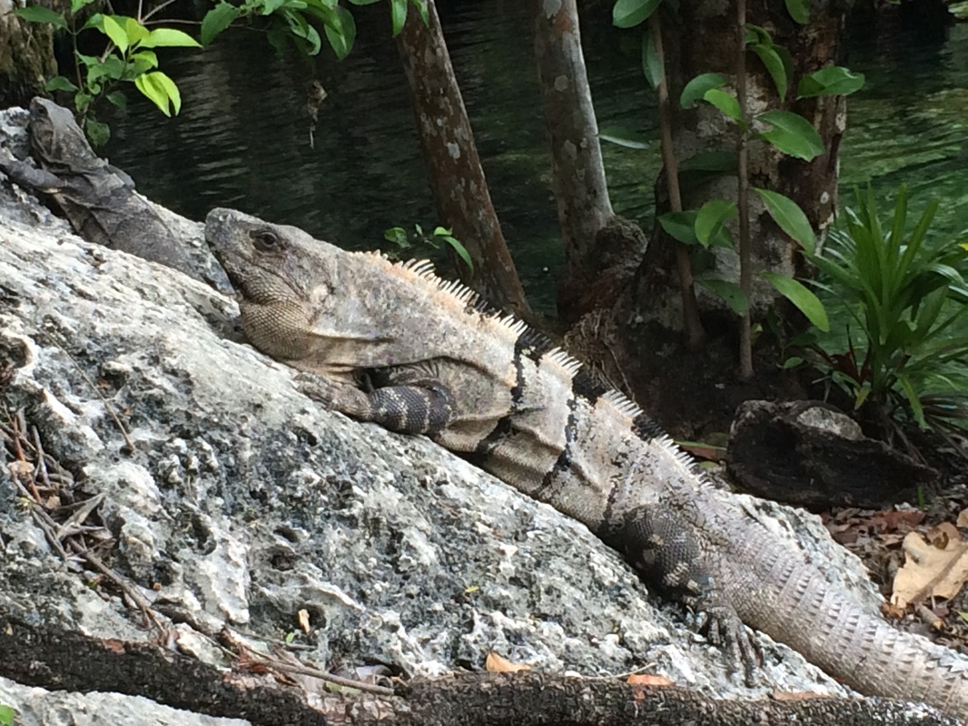
While the Mayan Riviera is known for its calm turquoise sea, we were reminded again that this is an El Niño year which resulted in some windy and rainy weather this spring. Having just spent six weeks in sunny Nicaragua we welcomed the clouds and cooler weather and headed inland to explore some different cenotes (definitely read Grant’s Powerpoint on ‘Cenotes and Mayans’ to give you a better overall description of this geological phenomena). 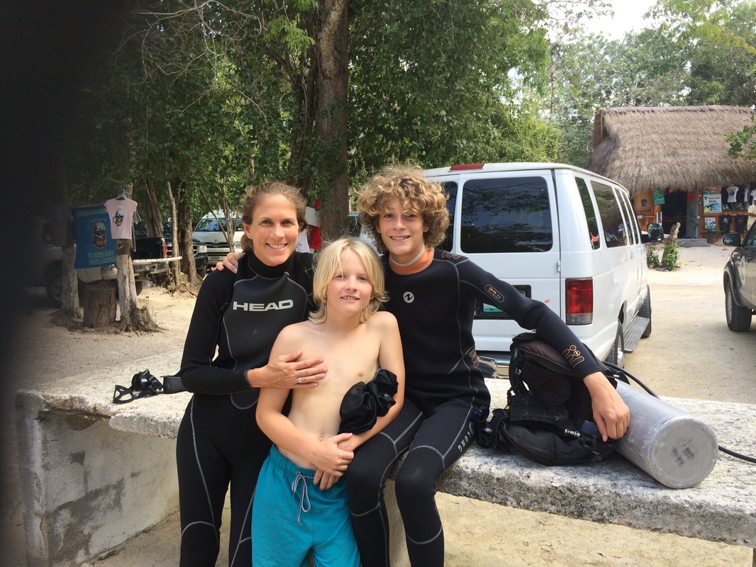
 Our amazing exploratory field trips during the day were followed by an evening of browsing the boutique shopping stalls at the town plaza, discovering a delicious restaurant, taking a salsa dance class, or listening to some live music in Puerto Morelos. One evening we found an amazing jazz trio and our wise son Grant suggested we “get a drink and listen to some music.” So, banana milk shakes and sweet jazz it was, and some very fond memories of our amazing week in Puerto Morelos.
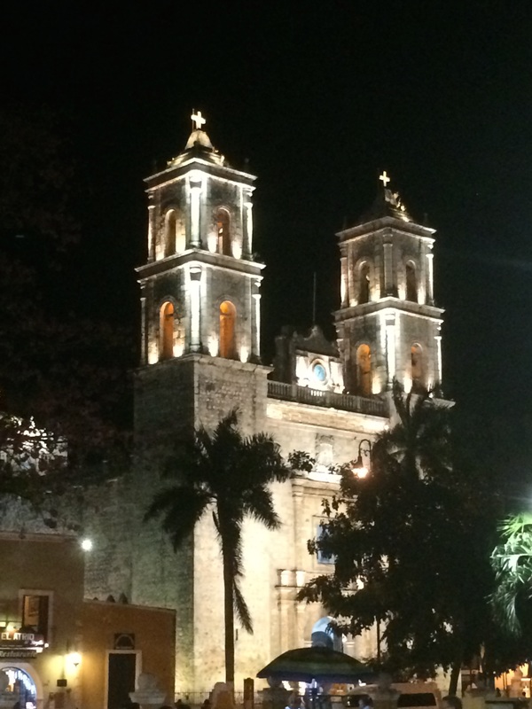
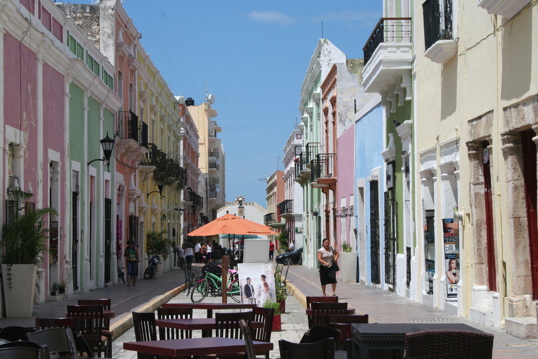
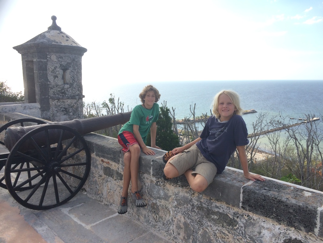
I would be hard pressed to try to capture all of our wonderful moments of this trip into one blog so instead will give you an insight into one evening in Vallodolid….. We finished eating our delicious dinner consisting of locally seasoned cerdo (pork) on freshly-made corn tortillas with pickled onions while looking out over the main town square. The lights capturing the beautifully built Cathedral de San Gervasi completed in 1570 and the sounds of a band, reminding me of childhood days listening to Desi Arnez’s band featured on “I love Lucy”, radiated from the town plaza. It was Sunday night in Valladolid, the night they close off the main street to car traffic and open it up to dancers. On our walk home, we couldn’t help but join the slowly growing number of dancers in the streets. While we didn’t have quite the same smooth dance moves as the Mexican couples, Ryan, Grant, Ethan and I practiced our salsa moves under the stars.
It’s moments like these that make me realize time and again how fortunate I am in life. I have an amazing husband and two wonderful boys who all are enjoying this year of travel and the crazy cacophony of diverse experiences we are sharing together as much as I am. We have many fantastic moments combined with some very average ones, a few scary experiences here and there, and lots of good conversation and quality time together that have given us memories that will last a life time. 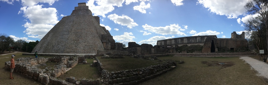 “Where did it go?”
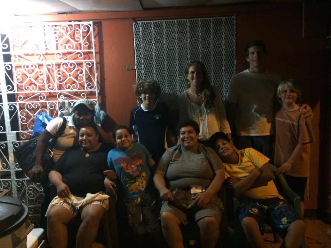
Searching through the ankle-deep caramel colored water of the Paria River, Grant and Ethan briefly see the trout’s dorsal fin break above the surface only to disappear in a quick flick of the tail. “There it is!” The boys frantically slosh across the barely submerged muddy floor, as Grant dips his hands to sweep a small section of the Paria in wide arcs. “Nothing.” Looking around and then looking at us, the boys are mystified that the trout as eluded them in such a shallow, open space. As the last bit of sun blazes across the red sandstone of Lee’s Ferry at the beginning of the Grand Canyon, we turn towards our camper and thoughts of dinner. The following morning, Amy and I paused our run at a small bridge upstream to stretch and as we looked down, we happened to see the trout half-beached on a sand bank having made only 50 more yards of its exhausted journey upstream. Looking down at the trout, I was struck by opposing thoughts. It is commonly known that, with much variation, the culminating act of a trout’s life cycle is swimming upstream to spawn in the same river it hatched (after all, trout are in the same family of salmon). In truth, though, only around 70-80% of salmon return to the stream of their birth as a certain smaller percentage wander to new and different streams. For the various species of salmon to remain healthy and viable, there needs to be this split: the majority returning to the familiar and a smaller percentage heading off to explore different locations and colonize different streams. This not only adds to genetic diversity with cross-breeding but also protects the species in case something catastrophic happens to the ‘mother stream’. In this way, salmon re-colonized streams after the last major ice-age, slowly migrating back north, for example, into British Columbia and Alaska. Likewise, though, this also protects the species from the opposite catastrophe of fruitless and errant wanderings as not every stream nor river is habitable and navigable, so it is vital for the majority of the species to return to proven breeding grounds. Thinking of it this way, evolution found this balance as species focusing too much on either extreme probably ran into some type of ‘extinction event’ that proved to be, literally, a dead end. In the Paria River, the trout’s instincts drove it relentlessly upstream even when it is clear that this was not a viable choice. But this trout’s actions were vital and necessary for the species as a whole even if this individual reached one of those ‘dead ends’. While seeing waste and necessity and the stark oppositions of death and survival, more importantly I am left with the powerful feeling of glimpsing the vibrant thriving of life. 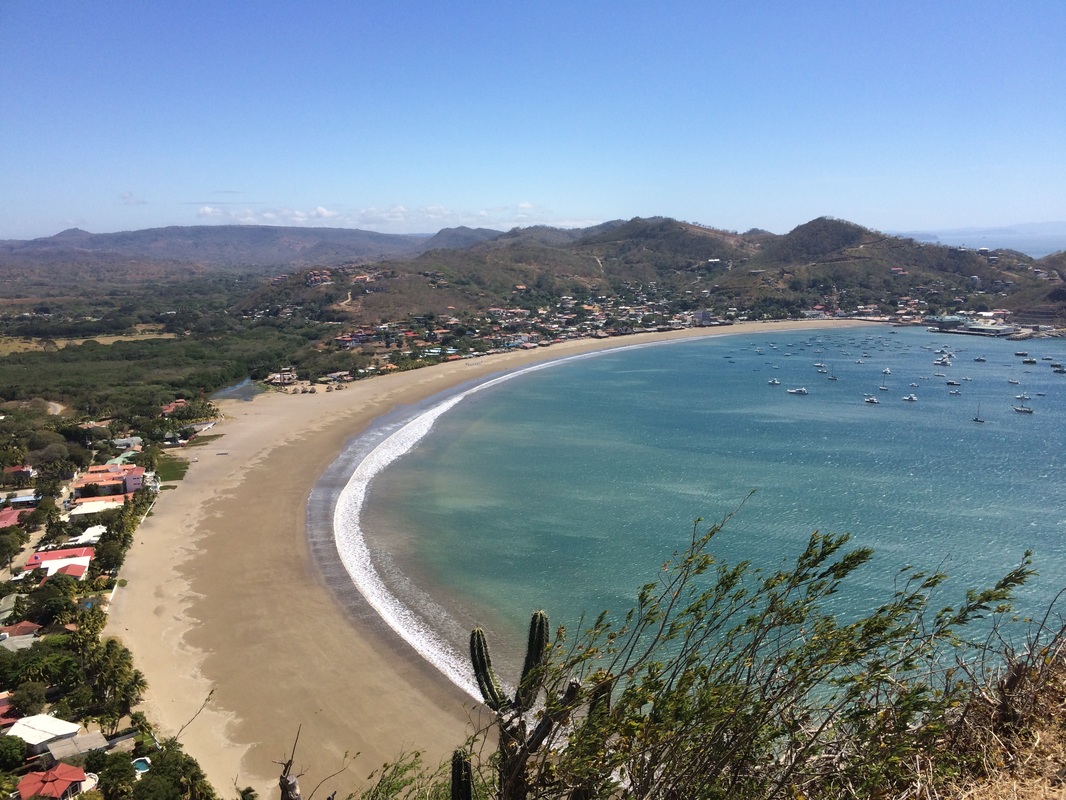 Arriving at 3AM is perhaps not the best way to begin a home stay with a family, but greeted with smiles and yawns at Casa Susana, we grabbed our bags, walked into our host family’s house, and our trip to Nicaragua officially started. Ryan, the boys, and I were all eager to learn Spanish and starting our trip to Nicaragua with a two week language course in San Juan Del Sur (SJDS) helped make the following nine weeks in Central America a fantastic experience for the whole family. It was very reassuring and convenient to have four people collaborating together when trying to bargain with a taxi driver, order food, rent surfboards, pay a bill, or just simply trying to chat up with anyone interested in having a conversation with us. While we certainly made the most progress learning Spanish while taking the course, I am happy to say we continued to learn and build off of our foundation throughout the rest of our trip. What made that possible was the the continual positive enthusiasm and energy we received from the Nicaraguans who just seemed so appreciative and happy that we were giving it a go speaking their language. Grant and Ethan were especially willing to jump into conversations with fellow children, grandparents and anyone in between. The warm reception from all the Nicaraguans we met as well as being willing to make mistakes (or maybe just being completely ignorant of our mistakes) helped us make continued progress and feel like we were a part of the community. 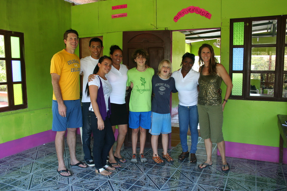
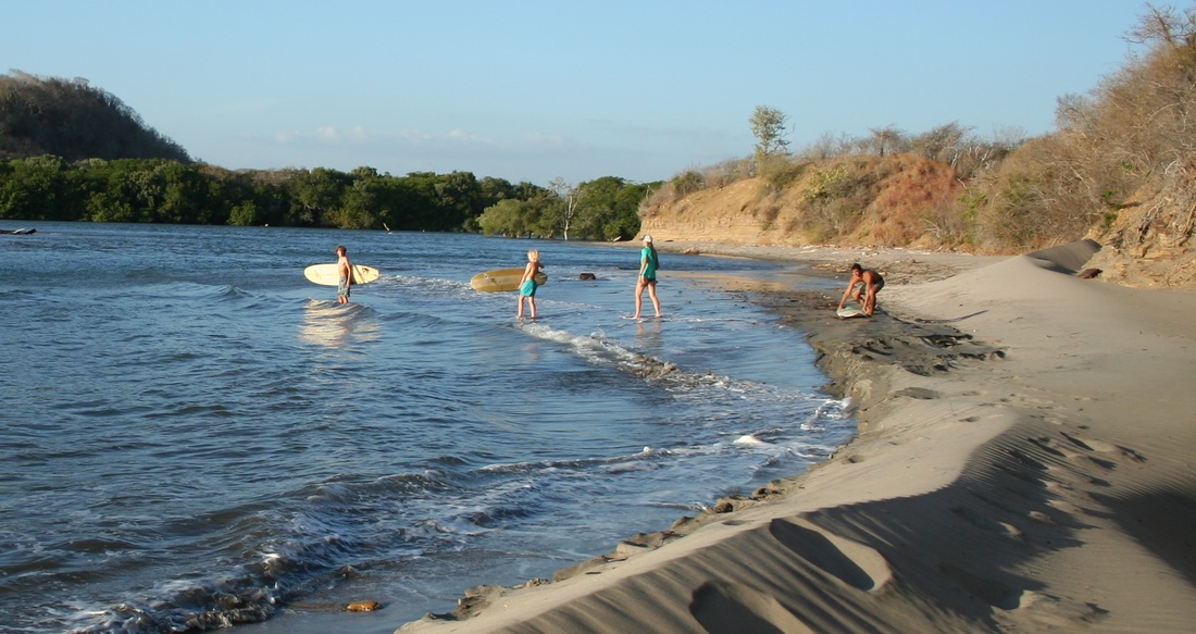
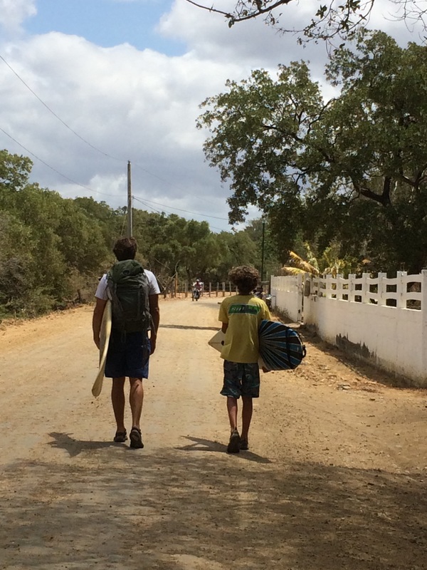
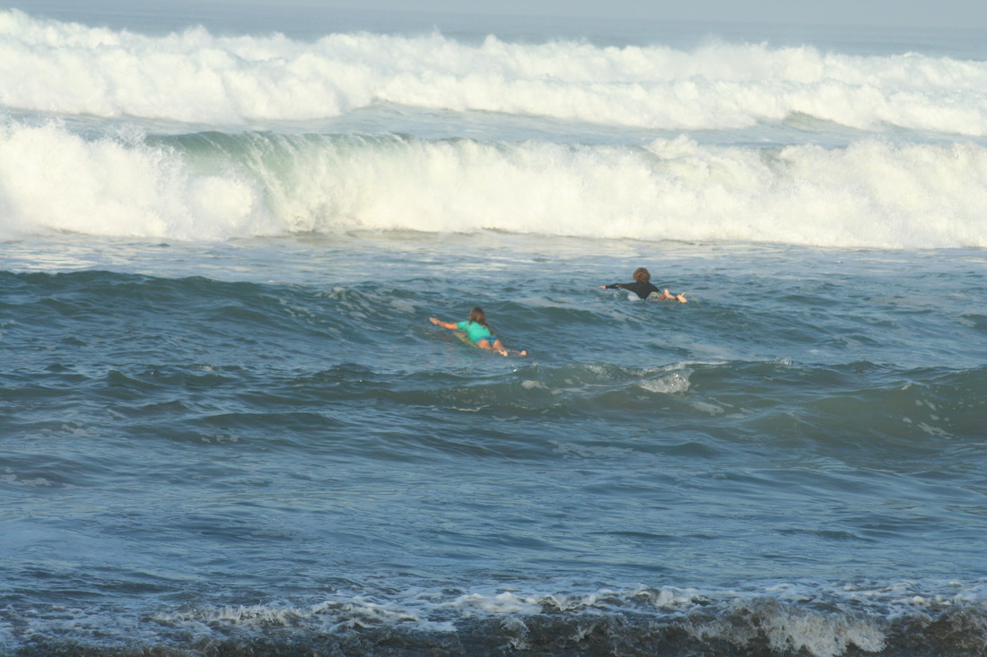
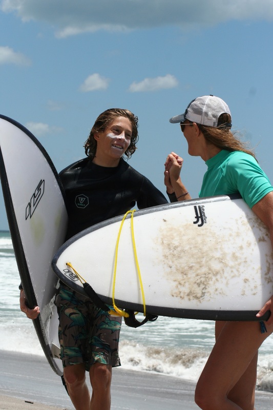
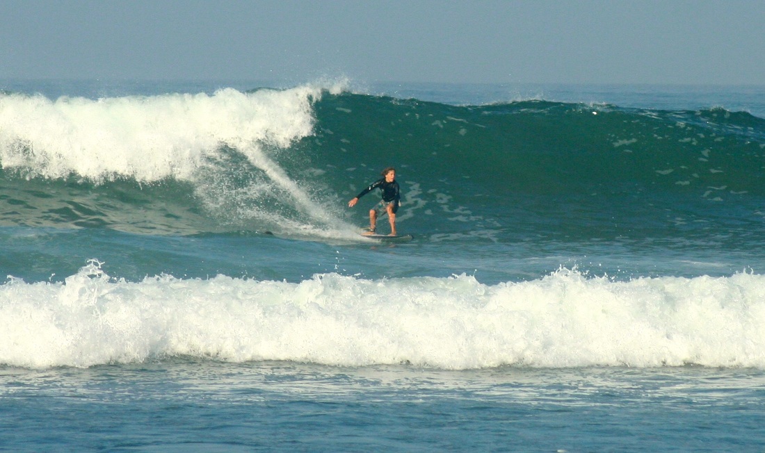
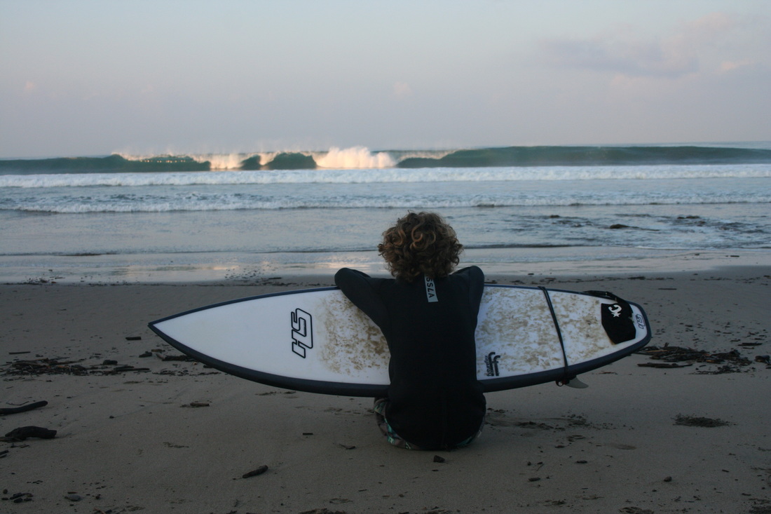 Dripping with sweat, covered with an interesting mix of sand adhered to sticky SPF, and combatting the gale force winds, I did wonder what we had gotten ourselves into and how I was personally going to survive the next three and a half weeks. It would take us a good 45 minutes to get to the break, and then you actually have to also figure out how to surf at a new break. Is it best to surf at high, low, incoming or outgoing tide? When are the least amount of people on the break? Does swell direction make a difference? Invariably, the sun would be going down by the time we started our walk home which most likely meant we would be walking home in the complete dark…. 
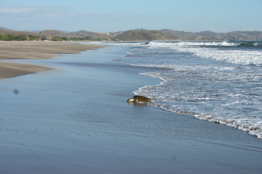
 The State of Turtles in Nicaragua
“Nothing is ever simple.” We walked north along the beach conflicted about what was happening behind us, as the two men picked up the Olive Ridley sea turtle for the fourth time and carried it back up the beach, dropping it into a man-made ‘nest’ they had scooped out of the sand in an effort to induce the sea turtle to lay its eggs. After lying prone for a few moments, the sea turtle awkwardly and slowly turned itself again toward the ocean and started crawling. As we walked away from the scene and periodically looked over our shoulders back down the beach, we saw one of the men drop to his knees and start digging another ‘nest’. For Nicaraguans, sea turtle eggs have traditionally been part of their diet and are also highly coveted as a good source of additional income due to the high price of turtle eggs. While there are protected areas for sea turtles along both coasts, generally being the areas where, during certain times of the year, thousands of turtles arrive each night to lay eggs, the majority of both coasts are unmonitored and egg harvesting goes on unchecked. Even more serious for the sea turtles population is the market and trade in sea turtle meat that still exists on the Caribbean Nicaraguan coastline. All five types of sea turtles that are found along the Nicaraguan coast are either endangered or critically endangered, but these cultural and economic realities make the issue of protecting these species much more complex. On the surface, the issue is simple from the view of protecting our threatened environment and stopping practices that could cause a species’ extinction. Our first response to seeing these two men on the beach with the turtle was to try to start a conversation in Spanish by saying, “Is she ready?”, and, politely, “Could you tell us what are you doing with the turtle?” Neither attempt was remotely acknowledged by the men and it was clear that they were intent on doing what they set out to do without any interference. From our environmental outlook, it was difficult to witness and not intervene in what was unfolding on the beach, but as we stood there debating what we could do, we all started talking about why this was happening both culturally and economically. We’ve talked with quite a few locals about the issue during our first month here and while attitudes are changing a bit towards protection, old habits and needs still take precedence. After starting to walk in silence further up the beach, a clearly conflicted Grant commented that “nothing is ever simple”. A few days later, though, we visited a protected wildlife reserve called Refugio de Vida Silvestre Río Escalante Chacocente (Wildlife Reserve Rio Escalante-Chacocente) further north up the coast. When the sea turtles start coming ashore to lay eggs (the “season” runs from July-December), people from the reserve dig up most of the eggs, transport them to nesting sites and protect them until they are ready to hatch, eventually bringing the hatchlings back down to the beach for release. As up to 20,000 turtles a month come ashore during September and October this amounts to quite a process but it was interesting to learn that members of the reserve work alongside local Nicaraguan families who are allowed to gather a set quota of eggs during the year in a way to successfully manage local needs with larger environmental goals. Even better, the reserve is attempting to be a community cooperative and has a wonderful website that explains their goals. It is true that ‘nothing is ever simple’ but working together towards a shared future is clearly the model going forward. We can all learn and benefit from a lesson like that. - Ryan Links for further reading: http://www.chacocente-nicaragua.com/english/home.html https://vianica.com/go/specials/4-sea_turtles_nicaragua.html Redwood. Sequoia. Bristlecone Pine. Joshua Tall. Burly. Old. Unique. What do you say when you are in the presence of these trees? 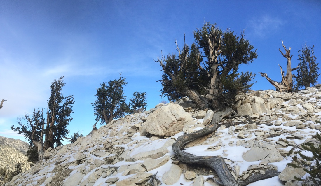
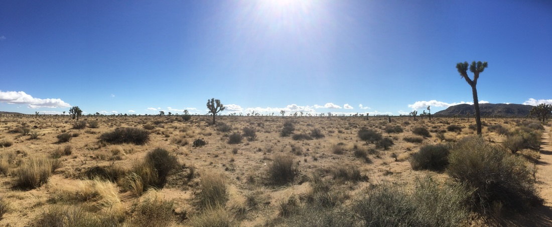
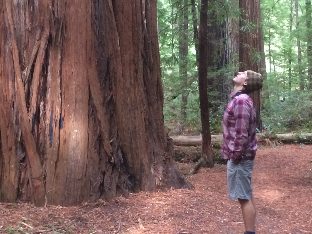
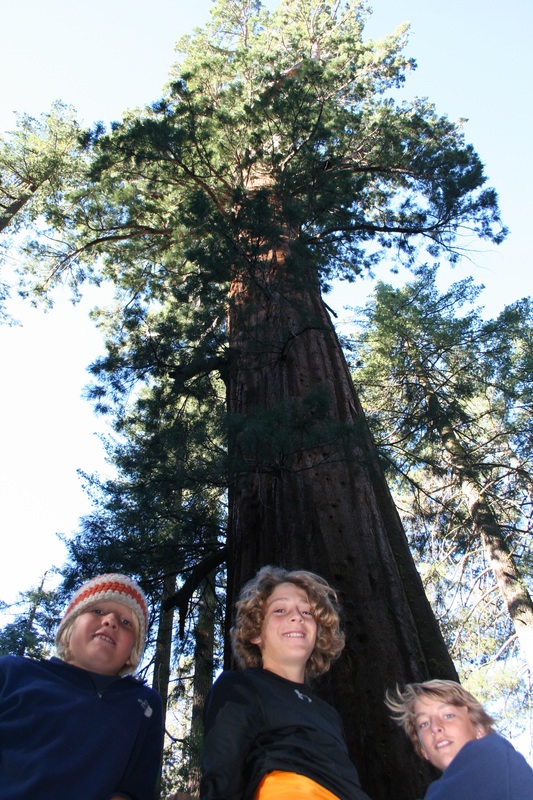
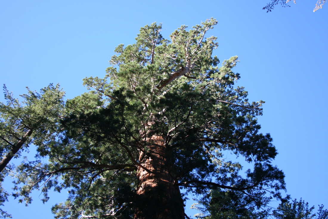
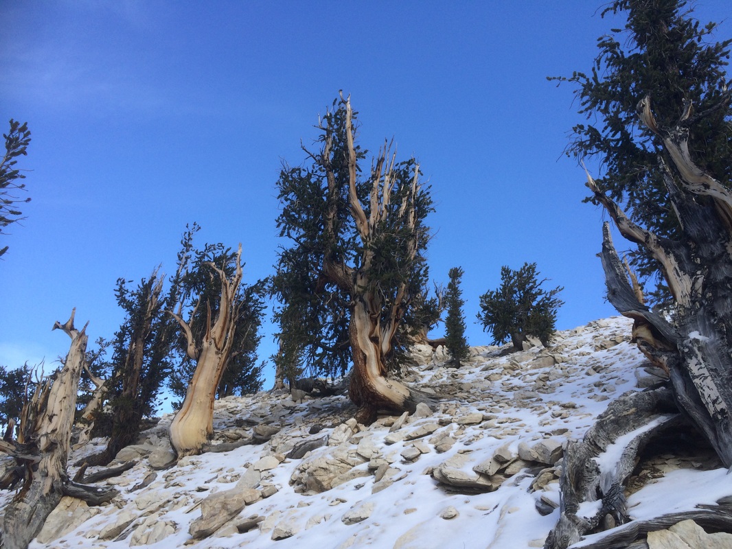
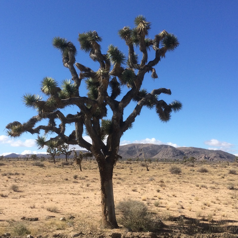
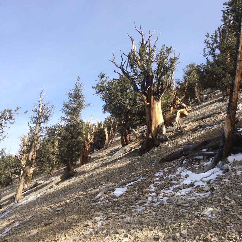
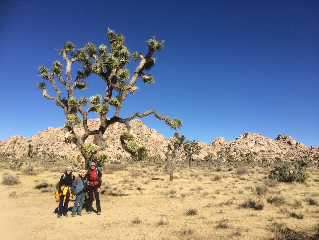
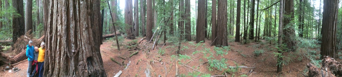 Four of some of the most iconic trees in the world inhabit one swath of the western United States and while their ranges do cross state lines, all four trees are found in California. From the Redwoods in the north, the more central Sequoias, the Ancient Bristlecone Pines of the eastern White Mountains and the Joshua Trees of southern California’s Mojave Desert, it is amazing to think that over the past month we travelled down an arc that had us encounter each of these amazing plants.
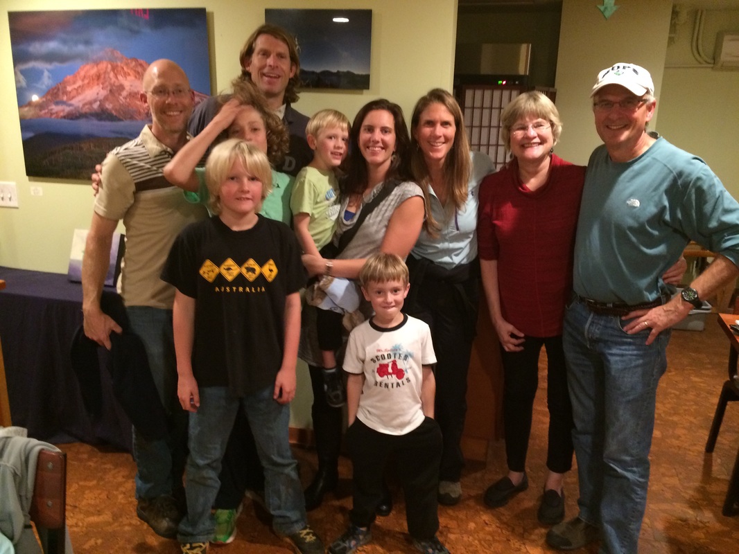
Fortunately for us, that arc also brought us within range of some dear friends and family. Our visit to northern California enabled us to stay with John, Michelle, Dylan and Cassidy Rutledge at their beautiful home (with a crazy driveway) and enjoy family life and explorations on the amazing landscape and beaches of Marin County. Celebrating John’s birthday on the beach at Point Reyes National Seashore was a highlight as was being joined there for the day by Megan Keiler and Tom Hudson who made the trek north from San Jose. This westside ‘Simsbury Reunion’ made us all feel a little better about missing (again) the annual Quogue Reunion that happened a few weeks earlier. Additionally, we were able to have a wonderful dinner with Ann, Andy and Tori Mathieson before heading southeast to Yosemite.
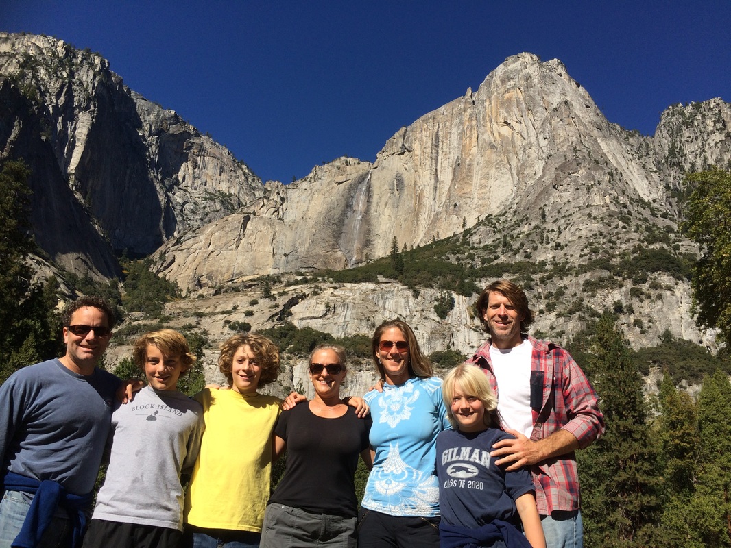
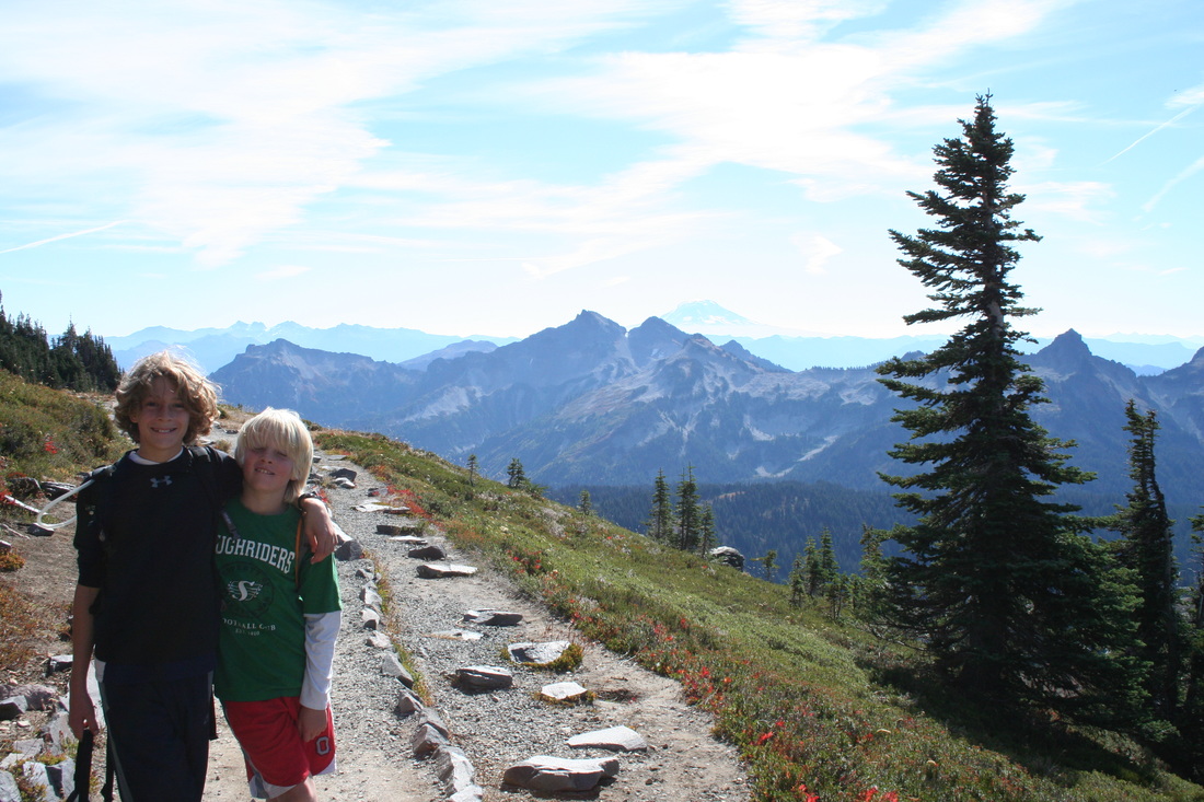
 As Yosemite deserves its own post, the key for now is to thank Adam, Rachael and Ben Ramsey for making the journey east from Palo Alto to see us in Yosemite. We unfortunately missed Abby but were able to see some pictures from her riding competition that happened the same weekend. From exploring ‘the Valley’, to scrambling up Lembert Dome on the Tioga Pass road, to a wonderful dual birthday dinner for Amy and Rachael at the Ahwanhnee Hotel, we got a much needed dose of family before racing across the Sierras on Sunday afternoon to outrun a storm that dumped 2” of rain in the Yosemite Valley and more than a foot of snow across Tioga Pass (which is now closed for the season). 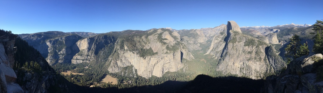 Our experiences in Yosemite, the Eastern Sierra and the deserts of California and Nevada will be documented in better detail later but this arc of travel has made all of us much more aware and thankful of those men and women whom had the tremendous foresight to work to defend, protect and preserve the groves, forests, mountains, rivers and deserts within which these special trees inhabit. These areas are much more than these four iconic trees and yet focusing on them allowed for ecosystems to be preserved and protected.  This fall we have seen the expansion of the United States during the 19th century as going through a series of stages, and, unfortunately, these stages are repeated nearly everywhere in the west: exploration, exploitation, domination, and, belatedly, preservation/conservation. While the last two terms are positive, these groups and individuals were fighting upstream against a culture and society that was decidedly moving in the opposite direction. These people saved what they could and while the damage had been done, it wasn’t irreparable. The struggle to conserve and preserve continues today and what we have learned above all is that we must all be stewards now and stand on their shoulders to complete and expand their life’s work.
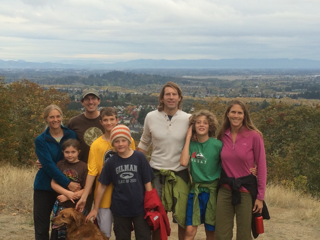
After Bend, we spent several days in Corvallis with Shannon Finley, one of my closest childhood friends, and her beautiful family. Our children had’t seen each other in several years and had never really gotten to know each other during our previous short visits, but you would have never known it. Grant, Ash, Ethan and Ayla palled on up and had the best time all weekend from mountain biking at the terrain park, playing ‘Bloody Wolf’ in the dark of the night (with their parents might I add), bouncing on the trampoline, hiking, and just simply playing outside with the neighborhood kids. Delicious food, wonderful connections with Shannon and Geoff, and especially finally seeing where Shannon and Geoff live in Oregon made the weekend so very enjoyable.
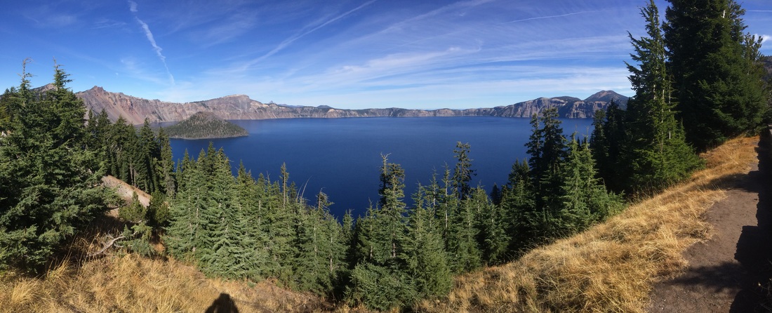
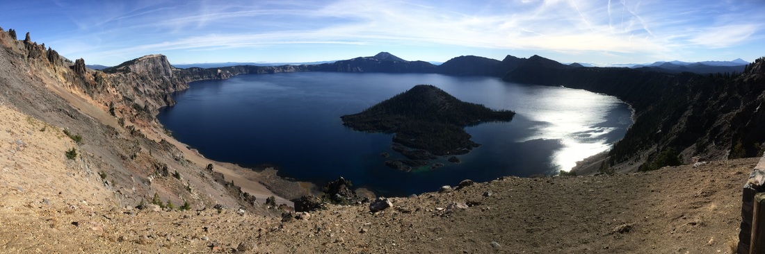
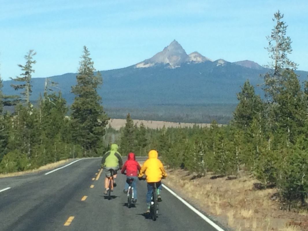
Our next destination was to the southern Oregon coast, and while Crater Lake National Park wasn’t quite on the way, we still made it a priority to get there. While it was the boys and my first trip to the park, Ryan had been there years earlier when working at Klamath Falls and had visited the park when there was over 270 inches of snow on the ground in early December. Situated at over 7000 feet in elevation, Crater Lake is a natural snow magnet accumulating regularly more than eleven feet a year. While the lake had not received any snow yet, the water looked spectacularly beautiful with it’s bluish green color somehow magnifying the crisp, cold fall day. It’s hard to imagine what the Klamath Native Americans must have thought when they witnessed the original volcano exploding a little over 6000 years ago, but needless to say the end results are truly a wonder to the eye today. Grant, Ryan, and Ethan decided to end their visit to Crater Lake by biking down from the rim and I happily obliged them by driving the car in the 42 degree weather, picking them up several miles down the road slightly chilled but happy nonetheless.
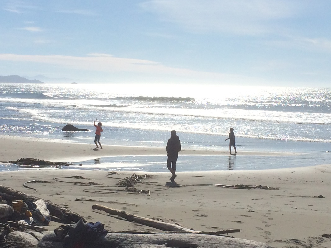
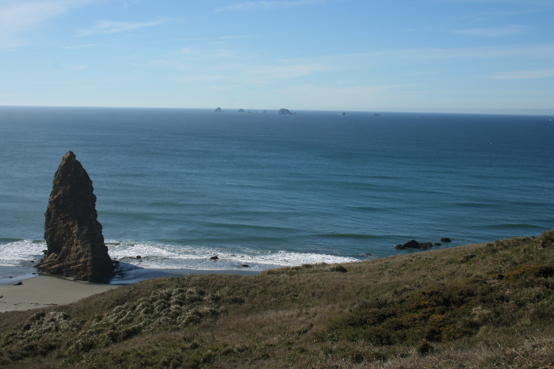
Leaving Crater Lake late in the afternoon meant that we did not get to the coastline until after dark, however, we had heard some great things about the little town of Bandon and were ever hopeful to get some fresh seafood for dinner. As luck would have it, we pulled into town at 6:56 PM and when most everything seemed to have already shut down, Ethan and I made it to the only crab shack that still had lights on by 6:58 and successfully got our order in before they closed at 7:00. We hungrily devoured some delicious clam chowder, crab cakes and fish tacos at Tony’s Crab Shack- a cute little restaurant/shop located right by the harbor that I highly recommend to anyone visiting there. This day could be the longest day yet of the whole trip as we still hadn’t made it to our final destination of Cape Blanco State Park, the furthest most western point of the continental USA, so we loaded back into the Bumble, started driving further south and a couple of hours later, well into the sleeping hours of the night, finally heard and saw the Cape Blanco lighthouse. Playing in the sand, biking to the lighthouse, walking/running/biking on the beach, searching for salmon, watching the waves roll in, basking in the fall sun, and finding whales right off the coast was a magical way to end our last few days in Oregon. I would happily come back for more when we can.
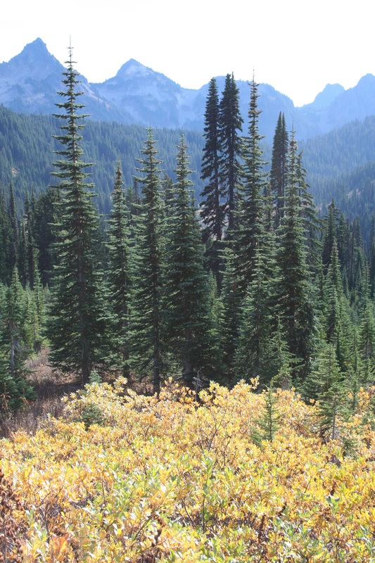
 The West is tied to water. People, trees and crops across southern Washington are literally attached to the major rivers of the Columbia and the Snake that weave along the state. Without these sources of water, the Palouse region and the neighboring scablands would be barren, regardless of the quality of the soil. In contrast, once the Cascades are reached the open lands of central and eastern Washington are gone, steadily replaced by a thicker and thicker weaves of evergreens. First Ponderosa Pines and then Douglass Firs and Western Hemlocks dominate the landscape and give testament to the amount of rain these areas normally receive.
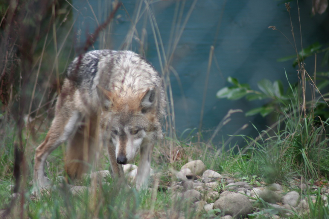
My cousin Mary-Kate, and her husband Phil, also live just outside these paths in Issaquah, and it was such a delight seeing her wonderful family as they brought us to their town’s salmon fish hatchery. It was great seeing Luke and Natalie run down to the river to show the boys the salmon swimming upstream and then bring us over to the fish ladders and tanks of the hatchery. Just two weeks earlier, Luke and Natalie’s school had their annual salmon festival at the start of the run and their infectious enthusiasm was still at a high. We continued to learn a lot about salmon throughout our time in the Northwest, from Amir’s work inspecting commercial salmon boats coming back into Puget Sound, the continuing restoration of the Elwha River’s salmon runs after its two dams were removed, to our wonderful walks in and talks with Park Rangers at the Olympic National Park Headquarters and the Hoh Rainforest. Just like wolves, salmon are the keystone species to this entire ecosystem directly feeding over 100 different animals and insects and thereby influencing and supporting this region’s amazingly rich biodiversity. It all seemed to come full circle when Vicki joined us in a visit to Wolf Haven, a reserve south of Olympia that cared for a variety of North American wolves, and the tour discussion turned to trophic cascades, keystone species and the importance of both salmon and wolves.
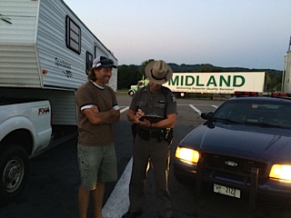
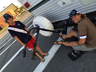
A few people are still curious as to what really happened to our bikes the first day of our trip, so I thought I would clear that up for anyone still wondering. Let me backtrack a little to August to help put the story in context. Did I mention that things were a little busy? Our shipment from Dubai was scheduled to arrive at my parents towards the end of the summer, so Ryan and I knew we needed to head down to Connecticut right after camp finished. In addition to collecting the gear for our cross country trip, we had to store the rest of our 61 boxes. (Yes, you read correctly, that was 61 different items shipped from Dubai. I truly have no idea what exactly is in all these boxes and am even more positive that there is nothing we need in those boxes, but they are now nicely tucked away in my loving parents’ attic.) We also needed to buy a generator, complete Ethan’s 1st communion with a family gathering and bonus Willie Nelson concert, and attend the fantastic wedding of Amy and Rags’ in the Berkshires. But this was all trivial to our most important responsibility which was to connect the camper van to the fifth wheel hitch that had just been newly installed onto our brand new, (to us), F250 turbo diesel 6.7, (note the new trucker talk lingo). Then, more importantly, we had to practice driving the colossally large Bumble/Careyvan duo before we left, and, oh, did I mention also get a license plate for the Careyvan too? 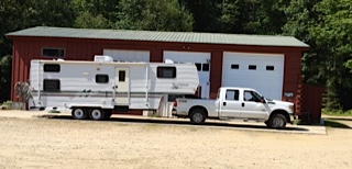 And then there were some additional details like finishing up some interior decorating of our new “deluxe” home, which is, in reality, the first home we ever really owned (perhaps not exactly the home our parents had imagined for us twenty years ago when we got married but a start none the less!). Then, we had to get it classroom ready, store all the new gear, clothes and food, and of course, find a way to bring our mountain bikes, a key component of how we wanted to explore the west. On that last note, we had called around to a few places trying to find a welder that could attach a hitch but no one was either free, able, or willing. We had tried to buy a bike attachment online but the order was backordered and would not be available for several weeks. We were starting to run short of time to our planned departure date of September 1st which was being strongly adhered to by my dear, sweet, and very determined Ryan. And so with some dutiful Google research, Ryan bought the components necessary to attach our bikes to the Careyvan the day before our departure. Bright and early the next day, Ryan attached the new bike rack and then started working on unrolling the awning with Biff. (It got conveniently stuck open the first time we opened it.) I followed up and started trying to fit the four bikes on the bike rack with the help of Ethan. If you’ve ever done this before you would appreciate that it is no easy task to try to fit four different sized bikes onto a bike rack. Ethan would lift one on, I would try the next, we would both lift another one together, we would rearrange and try again. Good times. Several hours later, bikes attached, awning retracted, and all systems loaded, we jumped into the Bumble/Careyvan combo to begin our first 10 hour drive to Cleveland. We were feeling pretty good, everything seemed to look really solid, and even Biff reviewed the system and gave us the thumbs up. Five hour later after driving through the bouncy, windy roads of Vermont into New York we made our first official gas stop. It did not take long before we rounded the back of the Careyvan and discovered there were no more bikes on the back of the Careyvan. It was that quick. Instead we found a bedraggled bike rack tilting unsteadily at a forty-five degree angle to the ground, with several of the straps missing. Since all of our bikes had been nicely locked together, they had a quick death getting ripped off the rack in one fell swoop somewhere along the highway in VT or NY. NY State Trooper McDaniel officially sealed the deal with a police report of our four lost bikes tragically taking place on the first day of our transcontinental homeschooling family gap year. Knowing I would one day find this comical, I did take some pictures to remember the event…….
|
AuthorAmy Archives
May 2016
Categories |

 RSS Feed